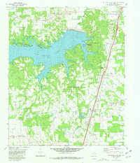
1980 Map of Pat Mayse Lake East
USGS Topo · Published 1981About this map
Camp Maxey dominates the central landscape of this Lamar County study, reflecting a significant military footprint just south of the Oklahoma border. The area is defined by the transition from established rural settlements like Forest Chapel, Chicota, and Powderly to the vast recreational and resource management zone of Pat Mayse Lake. This reservoir, formed along Sanders Creek, is flanked by Pat Mayse State Park, which includes designated areas like the Sanders Cove Public Use Area.
Find a feature on this map
42 named features on this map. Tap any name to fly to it.
Don’t see what you’re looking for? This feature index may not catch every label — zoom into the map to look around manually.
Map Details
Editions of this 1980 Pat Mayse Lake East Map
2 editions found
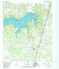
Other maps of this area

1903 · Paris
USGS Topo · 1:125,000

1948 · Grant
USGS Topo · 1:62,500

1948 · Paris
USGS Topo · 1:62,500

1949 · Grant
USGS Topo · 1:62,500

1949 · Paris
USGS Topo · 1:62,500

1951 · Slate Shoals
USGS Topo · 1:24,000

1951 · Shoals
USGS Topo · 1:24,000

1953 · Texarkana
USGS Topo · 1:250,000

1956 · Texarkana
USGS Topo · 1:250,000

1964 · Blossom
USGS Topo · 1:24,000