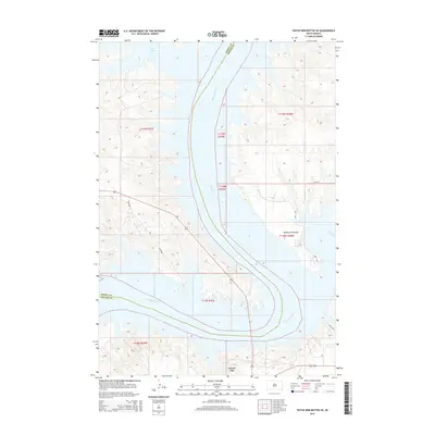
2015 Map of Patch Skin Buttes SE
USGS Topo · Published 2015About this map
Forest City stands as a primary point of reference on the eastern bank of the Missouri River, where the landscape is defined by the expansive waters of Lake Oahe. The map details a significant bend in the river, showing how the reservoir has shaped the geography of both Dewey and Potter counties. Topographic contours reveal the steep bluffs and complex drainage patterns leading down to the water, notably around Dolphus Peninsula. The road network is sparse, centered on rural routes like Swift Bird and grid-aligned sections such as 160th St, reflecting the area's transition between the rolling uplands and the river valley. This survey captures the rural character of the region, emphasizing the scale of the Missouri's course through central South Dakota.
Find a feature on this map
15 named features on this map. Tap any name to fly to it.
Don’t see what you’re looking for? This feature index may not catch every label — zoom into the map to look around manually.
Map Details
Editions of this 2015 Patch Skin Buttes SE Map
This is the sole edition of this map. No revisions or reprints were ever made.
Other maps of this area

1953 · McIntosh
USGS Topo · 1:250,000

1954 · Pierre
USGS Topo · 1:250,000

1958 · Pierre
USGS Topo · 1:250,000

1958 · McIntosh
USGS Topo · 1:250,000

1969 · Artichoke Butte NW
USGS Topo · 1:24,000

1969 · Patch Skin Buttes SW
USGS Topo · 1:24,000

1969 · Four Bear Creek
USGS Topo · 1:24,000

1969 · Patch Skin Buttes SE
USGS Topo · 1:24,000

1970 · Steamboat Creek
USGS Topo · 1:24,000

1970 · Patch Skin Buttes
USGS Topo · 1:24,000