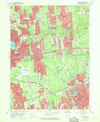
1967 Map of Patchogue
USGS Topo · Published 1970About this map
Long Island Mac Arthur Airport stands as a central anchor in this mid-century portrait of central Suffolk County, illustrating the post-war suburban transformation of the Long Island landscape. Large residential developments are etched into the grid between established village centers like Patchogue and Centereach, while the massive Long Island Expressway and Sunrise Highway corridors facilitate rapid regional growth. The map captures a high density of community institutions, from the Suffolk County Community College to numerous parochial centers such as the Cenacle Convent and St Josephs Sch & Church. These sprawling suburban neighborhoods are balanced by natural landmarks and recreational features, including the large glacial basin of Lake Ronkonkoma and the Selden Bicycle Path. From the Townhall City Hall in the south to the Coram Drive-in Theater in the north, the map documents a period of intense civic and infrastructure expansion.
Find a feature on this map
77 named features on this map. Tap any name to fly to it.
Don’t see what you’re looking for? This feature index may not catch every label — zoom into the map to look around manually.
Map Details
Editions of this 1967 Patchogue Map
2 editions found
Other maps of this area

1902 · Setauket
USGS Topo · 1:62,500

1902 · Fire Island
USGS Topo · 1:62,500

1903 · Fire Island
USGS Topo · 1:62,500

1904 · Setauket
USGS Topo · 1:62,500

1904 · Islip
USGS Topo · 1:125,000

1904 · Moriches
USGS Topo · 1:62,500

1919 · Setauket
USGS Topo · 1:62,500

1942 · Islip
USGS Topo · 1:125,000

1944 · Bay Shore East
USGS Topo · 1:24,000
1947 · St James
USGS Topo · 1:24,000