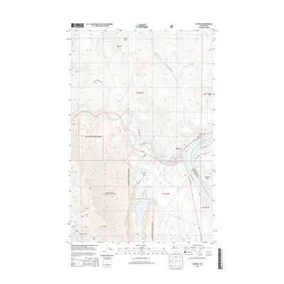
2014 Map of Pateros
USGS Topo · Published 2014About this map
The confluence of the Methow River and the Columbia River defines the location of Pateros, a riverside settlement situated at the intersection of critical water and land routes. This 2014 survey illustrates the complex topography of the region, where the deep incisions of Watson Draw and Spray Canyon cut through the high elevations of Buckhorn Mtn and Texas Mtn. The landscape is a mix of protected wilderness and recreation, with significant acreage dedicated to the Okanogan National Forest and the developed grounds of the Alta Lake Golf Course near the shores of Alta Lake. Transportation history is evident in labels like Pateros Ferry Rd NW, pointing to former river-crossing methods, while modern infrastructure follows the natural corridors of Alta Coulee and the riverbanks.
Find a feature on this map
42 named features on this map. Tap any name to fly to it.
Don’t see what you’re looking for? This feature index may not catch every label — zoom into the map to look around manually.
Map Details
Editions of this 2014 Pateros Map
This is the sole edition of this map. No revisions or reprints were ever made.
Other maps of this area

1899 · Methow
USGS Topo · 1:125,000

1901 · Chelan
USGS Topo · 1:125,000

1901 · Methow
USGS Topo · 1:125,000

1905 · Okanogan
USGS Topo · 1:125,000

1953 · Ritzville
USGS Topo · 1:250,000

1954 · Okanogan
USGS Topo · 1:250,000

1955 · Concrete
USGS Topo · 1:250,000

1957 · Brewster
USGS Topo · 1:62,500

1957 · Wenatchee
USGS Topo · 1:250,000

1958 · Concrete
USGS Topo · 1:250,000