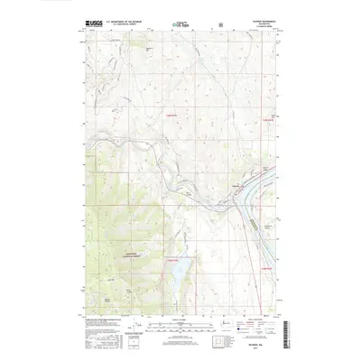
2017 Map of Pateros
USGS Topo · Published 2017About this map
Pateros sits at the confluence of the Methow River and the Columbia River, serving as a focal point for this 2017 study of the North Central Washington landscape. The town is flanked by dramatic elevation changes, rising from the riverbanks to Buckhorn Mtn and Goat Mtn to the west. The presence of Alta Lake and the nearby Alta Coulee suggests a complex geological history of glacial drainage and sediment deposit. The transportation network is anchored by Us-97 and SR-153, connecting the valley settlements to the higher reaches of the Okanogan National Forest. Local orchards are evidenced by names like Alamo Orchard Rd and Crane Orchard Rd, indicating the ongoing agricultural importance of the coulee and river terraces. Notable canyons such as Spray Canyon and Wadams Canyon carve through the southwestern portion of the quadrangle, illustrating the drainage patterns into the Methow valley.
Find a feature on this map
58 named features on this map. Tap any name to fly to it.
Don’t see what you’re looking for? This feature index may not catch every label — zoom into the map to look around manually.
Map Details
Editions of this 2017 Pateros Map
This is the sole edition of this map. No revisions or reprints were ever made.
Other maps of this area

1899 · Methow
USGS Topo · 1:125,000

1901 · Chelan
USGS Topo · 1:125,000

1901 · Methow
USGS Topo · 1:125,000

1905 · Okanogan
USGS Topo · 1:125,000

1953 · Ritzville
USGS Topo · 1:250,000

1954 · Okanogan
USGS Topo · 1:250,000

1955 · Concrete
USGS Topo · 1:250,000

1957 · Brewster
USGS Topo · 1:62,500

1957 · Wenatchee
USGS Topo · 1:250,000

1958 · Concrete
USGS Topo · 1:250,000