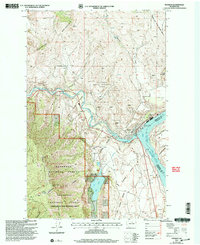
2001 Map of Pateros
USGS Topo · Published 2004About this map
Pateros sits at the vital confluence of the Methow River and the Pateros River branch of Lake Columbia, serving as a central hub for the surrounding orchard and recreation lands. The landscape at the turn of the 21st century is defined by high-elevation peaks like Buckhorn Mountain and Goat Mountain, while the river valleys host essential infrastructure including a Pumping Station, Aqueduct, and several Gravel Pits.
Find a feature on this map
33 named features on this map. Tap any name to fly to it.
Don’t see what you’re looking for? This feature index may not catch every label — zoom into the map to look around manually.
Map Details
Editions of this 2001 Pateros Map
This is the sole edition of this map. No revisions or reprints were ever made.
Other maps of this area

1899 · Methow
USGS Topo · 1:125,000

1901 · Chelan
USGS Topo · 1:125,000

1901 · Methow
USGS Topo · 1:125,000

1905 · Okanogan
USGS Topo · 1:125,000

1953 · Ritzville
USGS Topo · 1:250,000

1954 · Okanogan
USGS Topo · 1:250,000

1955 · Concrete
USGS Topo · 1:250,000

1957 · Brewster
USGS Topo · 1:62,500

1957 · Wenatchee
USGS Topo · 1:250,000

1958 · Concrete
USGS Topo · 1:250,000