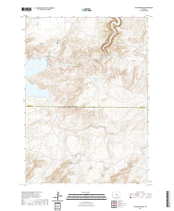
2021 Map of Pathfinder Dam
USGS Topo · Published 2021About this map
Pathfinder Dam stands as the central engineering feat where the North Platte River is constrained within the steep-walled Fremont Canyon. This modern topographic study reveals a landscape defined by dramatic elevation changes between the Pathfinder Reservoir and the surrounding high ground of Pathfinder Mtn and the Pedro Mountains. The presence of the Pathfinder Cem near the dam site provides a specific point of interest for researchers tracking the human history associated with the massive reclamation project.
Find a feature on this map
28 named features on this map. Tap any name to fly to it.
Don’t see what you’re looking for? This feature index may not catch every label — zoom into the map to look around manually.
Map Details
Editions of this 2021 Pathfinder Dam Map
This is the sole edition of this map. No revisions or reprints were ever made.
Other maps of this area

1950 · Alcova
USGS Topo · 1:24,000

1951 · Benton Basin SW
USGS Topo · 1:24,000

1951 · Benton Basin
USGS Topo · 1:24,000

1951 · Pathfinder Reservoir NW
USGS Topo · 1:24,000

1951 · Bear Spring
USGS Topo · 1:24,000

1951 · Pathfinder Dam
USGS Topo · 1:24,000

1953 · Leo
USGS Topo · 1:24,000

1953 · Pathfinder Reservoir SW
USGS Topo · 1:24,000

1953 · Fourmile Ridge
USGS Topo · 1:24,000

1955 · Casper
USGS Topo · 1:250,000