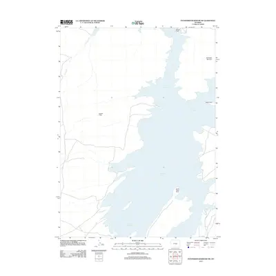
2012 Map of Pathfinder Reservoir NW
USGS Topo · Published 2012About this map
Pathfinder Reservoir dominates this central Wyoming landscape, where the high plains meet the intricate shorelines of the North Platte River system. The 2012 topography reveals a rugged shoreline defined by numerous promontories such as Bishop Point, Woolf Point, and Sand Creek Point. These features indicate the fluctuating water levels and complex geology of the area, providing a clear view of the reservoir’s northern reaches.
Find a feature on this map
8 named features on this map. Tap any name to fly to it.
Don’t see what you’re looking for? This feature index may not catch every label — zoom into the map to look around manually.
Map Details
Editions of this 2012 Pathfinder Reservoir NW Map
This is the sole edition of this map. No revisions or reprints were ever made.
Other maps of this area

1951 · Benton Basin SW
USGS Topo · 1:24,000

1951 · Benton Basin
USGS Topo · 1:24,000

1951 · Pathfinder Reservoir NW
USGS Topo · 1:24,000

1951 · Pathfinder Dam
USGS Topo · 1:24,000

1951 · Fort Ridge
USGS Topo · 1:24,000

1953 · Leo
USGS Topo · 1:24,000

1953 · Pathfinder Reservoir SW
USGS Topo · 1:24,000

1953 · Buzzard Ranch
USGS Topo · 1:24,000

1955 · Casper
USGS Topo · 1:250,000

1958 · Casper
USGS Topo · 1:250,000