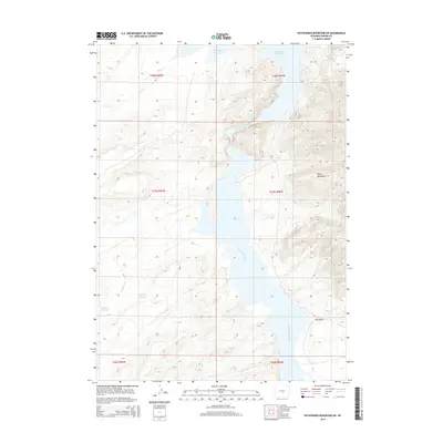
2015 Map of Pathfinder Reservoir SW
USGS Topo · Published 2015About this map
The North Platte River carves through the heart of this landscape, its waters feeding the expansive Pathfinder Reservoir in a region defined by high-elevation drainages and prominent peaks. To the east, the Pedro Mountains rise above the basin, while the surrounding terrain is etched by seasonal watercourses like Sunday Morning Cr, Deweese Cr, and the appropriately named Junk Cr. Small-scale water management is evident in the presence of the Spurlock Reservoir and Nickerson Reservoir, which highlight the necessity of water storage in this arid Wyoming environment. This 2015 survey illustrates how the contemporary landscape of Carbon County remains largely shaped by its topography and hydrology, with features such as Tye Draw and Sand Cr dictating the flow of the land toward the central river system.
Find a feature on this map
17 named features on this map. Tap any name to fly to it.
Don’t see what you’re looking for? This feature index may not catch every label — zoom into the map to look around manually.
Map Details
Editions of this 2015 Pathfinder Reservoir SW Map
This is the sole edition of this map. No revisions or reprints were ever made.
Other maps of this area

1951 · Pathfinder Reservoir NW
USGS Topo · 1:24,000

1951 · Pathfinder Dam
USGS Topo · 1:24,000

1951 · Fort Ridge
USGS Topo · 1:24,000

1953 · Leo
USGS Topo · 1:24,000

1953 · Bradley Peak
USGS Topo · 1:24,000

1953 · Seminoe Dam NE
USGS Topo · 1:24,000

1953 · Seminoe Dam
USGS Topo · 1:24,000

1953 · Pathfinder Reservoir SW
USGS Topo · 1:24,000

1953 · Buzzard Ranch
USGS Topo · 1:24,000

1955 · Casper
USGS Topo · 1:250,000