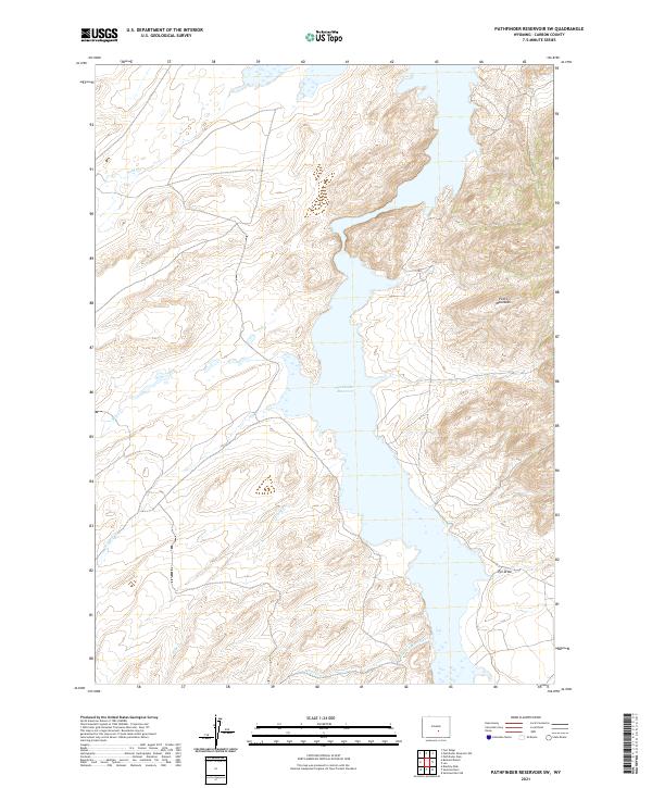
2021 Map of Pathfinder Reservoir SW
USGS Topo · Published 2021About this map
Pathfinder Reservoir dominates this central Wyoming landscape, filling a deep basin carved through the high plains and rocky uplands of Carbon County. To the east, the Pedro Mountains rise sharply from the shoreline, their steep ridges defining the eastern edge of the reservoir. The topography is marked by a complex drainage system where seasonal and perennial streams like Sunday Morning Cr and Junk Cr cut through the terrain to join the main water body. The presence of Tye Draw and the various creek beds such as Sand Cr and Deweese Cr reveal a landscape shaped by water erosion in an arid environment. This 2021 survey illustrates the modern extent of the reservoir's reach into the surrounding mountain foothills, highlighting the intersection of high-altitude desert hydrology and mountain geography.
Find a feature on this map
15 named features on this map. Tap any name to fly to it.
Don’t see what you’re looking for? This feature index may not catch every label — zoom into the map to look around manually.
Map Details
Editions of this 2021 Pathfinder Reservoir SW Map
This is the sole edition of this map. No revisions or reprints were ever made.
Other maps of this area

1951 · Pathfinder Reservoir NW
USGS Topo · 1:24,000

1951 · Pathfinder Dam
USGS Topo · 1:24,000

1951 · Fort Ridge
USGS Topo · 1:24,000

1953 · Leo
USGS Topo · 1:24,000

1953 · Bradley Peak
USGS Topo · 1:24,000

1953 · Seminoe Dam NE
USGS Topo · 1:24,000

1953 · Seminoe Dam
USGS Topo · 1:24,000

1953 · Pathfinder Reservoir SW
USGS Topo · 1:24,000

1953 · Buzzard Ranch
USGS Topo · 1:24,000

1955 · Casper
USGS Topo · 1:250,000