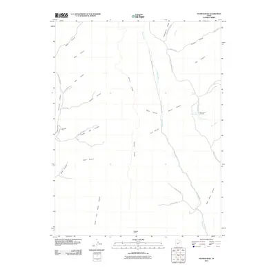
2011 Map of Patmos Head
USGS Topo · Published 2011About this map
Patmos Head and the surrounding high-altitude desert plateaus of Carbon County define this landscape as it appeared in the early 21st century. The map centers on the dramatic Patmos Ridge, which acts as a topographical spine separating Whitmore Canyon to the west from the deep drainage of Range Creek to the east. This area reflects a long history of resource extraction and seasonal land use, evidenced by the presence of the Sunnyside Mine and its associated Bathhouse infrastructure on the western edge. To the east, the landscape transitions toward isolated grazing and water sources, such as Willow Spring Cow Camp, North Willow Spring, and Dalton Spring. A network of unpaved roads, including Patmos Head Rd and Range Creek Rd, provides the only access through this complex system of canyons and ridges.
Find a feature on this map
37 named features on this map. Tap any name to fly to it.
Don’t see what you’re looking for? This feature index may not catch every label — zoom into the map to look around manually.
Map Details
Editions of this 2011 Patmos Head Map
This is the sole edition of this map. No revisions or reprints were ever made.
Other maps of this area

1886 · Price River
USGS Topo · 1:250,000

1896 · Price River
USGS Topo · 1:250,000

1915 · Sunnyside
USGS Topo · 1:62,500

1948 · Woodside
USGS Topo · 1:62,500

1949 · Woodside
USGS Topo · 1:62,500

1950 · Woodside
USGS Topo · 1:62,500

1954 · Flat Canyon
USGS Topo · 1:62,500

1954 · Range Creek
USGS Topo · 1:62,500

1956 · Price
USGS Topo · 1:250,000

1960 · Price
USGS Topo · 1:250,000