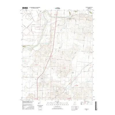
2016 Map of Patoka
USGS Topo · Published 2016About this map
The confluence of the White River and the Patoka River dominates this portion of the Indiana landscape, where the border between Knox and Gibson counties is defined by the winding river channels. The settlement of Hazleton sits at a strategic bend in the north, while the town of Patoka serves as a central hub further south, bridged by the CSX rail line. This area is characterized by a dense network of drainage ditches such as Thompson Ditch, Hull Ditch, and Trippet Ditch, illustrating the managed hydrology required for the region's agricultural productivity.
Find a feature on this map
98 named features on this map. Tap any name to fly to it.
Don’t see what you’re looking for? This feature index may not catch every label — zoom into the map to look around manually.
Map Details
Editions of this 2016 Patoka Map
This is the sole edition of this map. No revisions or reprints were ever made.
Other maps of this area

1901 · Princeton
USGS Topo · 1:62,500

1902 · Ditney
USGS Topo · 1:125,000

1903 · Petersburg
USGS Topo · 1:62,500

1903 · Princeton
USGS Topo · 1:62,500

1903 · Patoka
USGS Topo · 1:125,000

1915 · Vincennes
USGS Topo · 1:62,500

1944 · Iona
USGS Topo · 1:24,000

1944 · Vincennes
USGS Topo · 1:62,500

1956 · Vincennes
USGS Topo · 1:250,000

1957 · Vincennes
USGS Topo · 1:250,000