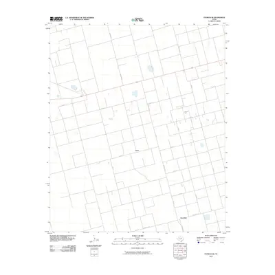
2010 Map of Patricia NE
USGS Topo · Published 2010About this map
Union sits at a crossroads in the High Plains of West Texas, anchoring a landscape defined by geometric section lines and oil extraction. This 2010 survey reveals the persistent agricultural and industrial grid of Dawson County, where the Gin Oil Field indicates the region's long-standing reliance on petroleum resources. Further south, the settlement of Friendship appears near the junction of Ranch Rd 829 and Ranch Rd 2051, illustrating the scattered nature of community centers in this wide-open terrain. The map is dominated by an extensive network of rural routes, including Stafford Rd and several alphabetical and numerical county roads like Co Rd 18 and Co Rd C. These roads trace the property boundaries of the Llano Estacado, serving as the primary infrastructure for both ranching operations and the energy industry.
Find a feature on this map
18 named features on this map. Tap any name to fly to it.
Don’t see what you’re looking for? This feature index may not catch every label — zoom into the map to look around manually.
Map Details
Editions of this 2010 Patricia NE Map
This is the sole edition of this map. No revisions or reprints were ever made.
Other maps of this area

1954 · Hobbs
USGS Topo · 1:250,000

1954 · Big Spring
USGS Topo · 1:250,000

1958 · Big Spring
USGS Topo · 1:250,000

1958 · Hobbs
USGS Topo · 1:250,000

1968 · Lamesa North
USGS Topo · 1:24,000

1969 · Welch SW
USGS Topo · 1:24,000

1969 · Punkin Center
USGS Topo · 1:24,000

1970 · Patricia SW
USGS Topo · 1:24,000

1970 · Patricia
USGS Topo · 1:24,000

1970 · Lamesa South
USGS Topo · 1:24,000