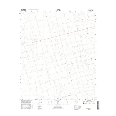
2016 Map of Patricia NE
USGS Topo · Published 2016About this map
Agricultural grid lines and ranching infrastructure define this section of the High Plains north of Patricia. The landscape is characterized by a network of rural corridors, including Ranch Rd 829 and Ranch Rd 2051, which connect the scattered homesteads and farming operations of Dawson County. The terrain is marked by numerous ephemeral wetlands or playas, typical of the Llano Estacado, which provide a stark contrast to the rigid geometry of the local road system. This survey illustrates the persistence of the rectangular land survey system in West Texas, where local routes like Stafford Rd and Co Rd G follow section lines across the flat expanse. The map also shows the transition between state-maintained farm-to-market roads, such as Fm 2052, and the smaller county lanes that provide access to the interior of these large agricultural blocks.
Find a feature on this map
16 named features on this map. Tap any name to fly to it.
Don’t see what you’re looking for? This feature index may not catch every label — zoom into the map to look around manually.
Map Details
Editions of this 2016 Patricia NE Map
This is the sole edition of this map. No revisions or reprints were ever made.
Other maps of this area

1954 · Hobbs
USGS Topo · 1:250,000

1954 · Big Spring
USGS Topo · 1:250,000

1958 · Big Spring
USGS Topo · 1:250,000

1958 · Hobbs
USGS Topo · 1:250,000

1968 · Lamesa North
USGS Topo · 1:24,000

1969 · Welch SW
USGS Topo · 1:24,000

1969 · Punkin Center
USGS Topo · 1:24,000

1970 · Patricia SW
USGS Topo · 1:24,000

1970 · Patricia
USGS Topo · 1:24,000

1970 · Lamesa South
USGS Topo · 1:24,000