
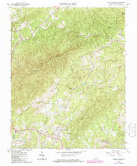
1967 Map of Patrick Springs
USGS Topo · Published 1968About this map
Patrick Springs serves as the focal point for this 1967 survey, situated in the foothills where the terrain begins its ascent toward Bull Mountain. The settlement pattern reflects the area's agricultural and rural social life, anchored by numerous community centers such as Buffalo Ridge Ch, Liberty Ch, and the Hardin Reynolds Memorial Sch. Cultural landmarks of the mid-century era are visible, including a Drive-in Theater and the Patrick Memorial Gardens.
Find a feature on this map
34 named features on this map. Tap any name to fly to it.
Don’t see what you’re looking for? This feature index may not catch every label — zoom into the map to look around manually.
Map Details
Editions of this 1967 Patrick Springs Map
2 editions found
Other maps of this area

1926 · Critz
USGS Topo · 1:48,000

1928 · Stuart
USGS Topo · 1:48,000

1928 · Critz
USGS Topo · 1:62,500

1931 · Stuart
USGS Topo · 1:62,500

1953 · Winston-Salem
USGS Topo · 1:250,000

1955 · Winston-Salem
USGS Topo · 1:250,000

1957 · Endicott
USGS Topo · 1:62,500

1957 · Floyd
USGS Topo · 1:62,500

1962 · Winston-Salem
USGS Topo · 1:250,000
1967 · Spencer
USGS Topo · 1:24,000