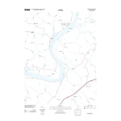
2013 Map of Patriot
USGS Topo · Published 2013About this map
The Ohio River carves a sweeping path through this borderland region, defining the landscape and historical development of the area. On the Indiana side, the town of Patriot sits perched on the riverbank, supported by the fertile lowlands of Egypt Bottom and Steele Bottom. These riverbottoms contrast with the upland terrain of Searcy Ridge and Wade Hill, where small settlements like Searcy Crossroads and Gurley Corner developed along the winding ridgeline roads. Across the water in Kentucky, the terrain is deeply dissected by numerous watercourses, including Paint Lick Cr and Big Bone Cr, the latter flowing past the prominent Big Bone Island.
Find a feature on this map
92 named features on this map. Tap any name to fly to it.
Don’t see what you’re looking for? This feature index may not catch every label — zoom into the map to look around manually.
Map Details
Editions of this 2013 Patriot Map
This is the sole edition of this map. No revisions or reprints were ever made.
Other maps of this area

1943 · Florence
USGS Topo · 1:24,000

1943 · Aberdeen
USGS Topo · 1:24,000

1943 · Rising Sun
USGS Topo · 1:24,000

1943 · Patriot
USGS Topo · 1:24,000

1950 · Glencoe
USGS Topo · 1:24,000

1950 · Elliston
USGS Topo · 1:24,000

1950 · Union
USGS Topo · 1:24,000

1950 · Verona
USGS Topo · 1:24,000

1951 · Florence
USGS Topo · 1:24,000

1951 · Rising Sun
USGS Topo · 1:24,000