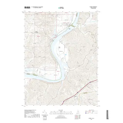
2019 Map of Patriot
USGS Topo · Published 2019About this map
Patriot sits prominently along a deep bend of the Ohio River, anchoring a landscape defined by fertile river lowlands and steep upland ridges. This modern survey illustrates the agricultural character of the region, where broad alluvial flats like Mexico Bottom, Steele Bottom, and Egypt Bottom are tucked against the river’s edge. The terrain rises sharply toward Searcy Ridge and Mead Ridge, where small family burial sites such as McNutt Cem and Jack Cem dot the higher elevations, providing vital reference points for local genealogists.
Find a feature on this map
112 named features on this map. Tap any name to fly to it.
Don’t see what you’re looking for? This feature index may not catch every label — zoom into the map to look around manually.
Map Details
Editions of this 2019 Patriot Map
This is the sole edition of this map. No revisions or reprints were ever made.
Other maps of this area

1943 · Florence
USGS Topo · 1:24,000

1943 · Aberdeen
USGS Topo · 1:24,000

1943 · Rising Sun
USGS Topo · 1:24,000

1943 · Patriot
USGS Topo · 1:24,000

1950 · Glencoe
USGS Topo · 1:24,000

1950 · Elliston
USGS Topo · 1:24,000

1950 · Union
USGS Topo · 1:24,000

1950 · Verona
USGS Topo · 1:24,000

1951 · Florence
USGS Topo · 1:24,000

1951 · Rising Sun
USGS Topo · 1:24,000