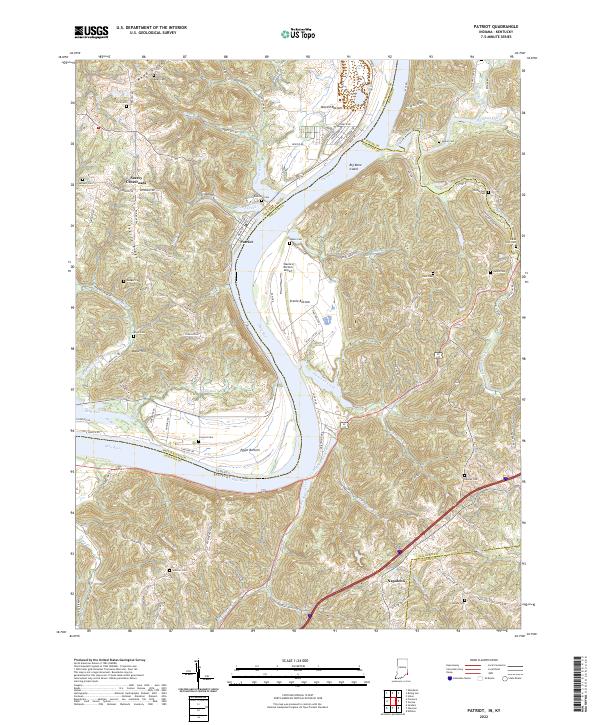
2022 Map of Patriot
USGS Topo · Published 2022About this map
The Ohio River forms a wide, sweeping bend at the heart of this landscape, separating Switzerland County, Indiana, from the Kentucky counties of Boone, Gallatin, and Grant. Along the river’s floodplain, fertile areas known as Mexico Bottom, Steele Bottom, and Egypt Bottom reflect a long history of agricultural utilization. The settlement of Patriot sits perched on the Indiana bank, while Napoleon lies further inland to the southeast. High ridges and deep creek valleys define the local topography, with Mead Ridge and Searey Ridge offering significant elevation over the river valley. Numerous family burial grounds, such as McNutt Cem, Richardson Cem, and Dawley Cem, are scattered across these hills, providing essential data points for genealogical research. Transportation follows the natural contours of the land, ranging from the Steele's Bottom Airport on the river flats to the winding courses of Goose Creek and Paint Lick Creek.
Find a feature on this map
105 named features on this map. Tap any name to fly to it.
Don’t see what you’re looking for? This feature index may not catch every label — zoom into the map to look around manually.
Map Details
Editions of this 2022 Patriot Map
This is the sole edition of this map. No revisions or reprints were ever made.
Other maps of this area

1943 · Florence
USGS Topo · 1:24,000

1943 · Aberdeen
USGS Topo · 1:24,000

1943 · Rising Sun
USGS Topo · 1:24,000

1943 · Patriot
USGS Topo · 1:24,000

1950 · Glencoe
USGS Topo · 1:24,000

1950 · Elliston
USGS Topo · 1:24,000

1950 · Union
USGS Topo · 1:24,000

1950 · Verona
USGS Topo · 1:24,000

1951 · Florence
USGS Topo · 1:24,000

1951 · Rising Sun
USGS Topo · 1:24,000