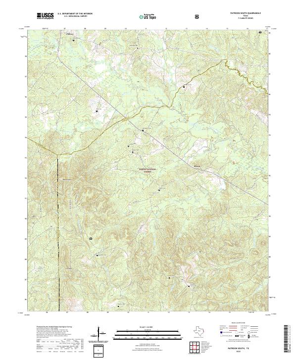
2022 Map of Patroon South
USGS Topo · Published 2022About this map
Sabine National Forest dominates the terrain of this East Texas quadrangle, where the borders of Shelby and San Augustine counties meet. Small communities like Patroon and Sexton serve as focal points in a landscape defined by an extensive network of cemeteries, reflecting the area's deep-rooted family histories. Notable burial sites including Munnerlyn Cem, Windham Cem, and Williams Family Cem are scattered throughout the wooded hills. The topography is marked by significant elevations such as Matlock Hills and Forse Mtn, which rise above a complex drainage system fed by Patroon Bayou and El Lobanillo Cr. The map details a mix of forest service roads and county routes, including US Hwy Forest Road 131 and FM 2261, which navigate the dense timberland and rural homesteads of the Sabine River basin.
Find a feature on this map
61 named features on this map. Tap any name to fly to it.
Don’t see what you’re looking for? This feature index may not catch every label — zoom into the map to look around manually.
Map Details
Editions of this 2022 Patroon South Map
This is the sole edition of this map. No revisions or reprints were ever made.
Other maps of this area

1944 · Patroon
USGS Topo · 1:62,500

1953 · Alexandria
USGS Topo · 1:250,000

1953 · Palestine
USGS Topo · 1:250,000

1955 · Alexandria
USGS Topo · 1:250,000

1956 · Patroon
USGS Topo · 1:62,500

1957 · Palestine
USGS Topo · 1:250,000

1958 · Hemphill
USGS Topo · 1:62,500

1958 · San Augustine
USGS Topo · 1:62,500

1958 · Bronson
USGS Topo · 1:62,500
1984 · Milam
USGS Topo · 1:24,000