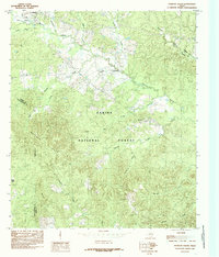
1984 Map of Patroon South
USGS Topo · Published 1985About this map
Sabine National Forest dominates the southern landscape of this East Texas quadrangle, where the dense woodlands are carved by a complex network of bayous and creeks. In the mid-1980s, the small communities of Patroon and Sexton serve as local hubs, connected by winding roads through the Matlock Hills. The drainage pattern is particularly intricate here, with Patroon Bayou and Martinez Bayou collecting waters from numerous tributaries like Mushotuba Creek and El Lobanillo Creek.
Find a feature on this map
27 named features on this map. Tap any name to fly to it.
Don’t see what you’re looking for? This feature index may not catch every label — zoom into the map to look around manually.
Map Details
Editions of this 1984 Patroon South Map
This is the sole edition of this map. No revisions or reprints were ever made.
Other maps of this area

1944 · Patroon
USGS Topo · 1:62,500

1953 · Alexandria
USGS Topo · 1:250,000

1953 · Palestine
USGS Topo · 1:250,000

1955 · Alexandria
USGS Topo · 1:250,000

1956 · Patroon
USGS Topo · 1:62,500

1957 · Palestine
USGS Topo · 1:250,000

1958 · Hemphill
USGS Topo · 1:62,500

1958 · San Augustine
USGS Topo · 1:62,500

1958 · Bronson
USGS Topo · 1:62,500
1984 · Milam
USGS Topo · 1:24,000