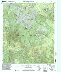
2003 Map of Patroon South
USGS Topo · Published 2004About this map
Sabine National Forest dominates this landscape on the border of Shelby, Sabine, and San Augustine counties, where the terrain shifts from the low drainages of Patroon Bayou and Patroon Creek to the high ground of Chinquapin Ridge and Forse Mountain. The settlement pattern reflects a deeply rooted rural community, anchored by crossroads like Sexton and Black Ankle and a network of family-linked sites. Researchers will find numerous small cemeteries and country churches, including Smith Cemetery, Crockett Cemetery, and New Jerusalem Ch, scattered along winding roads like Smith Cemetery Road. The complex hydrology of the region is evident in the dense branching of Lobanillo Creek and Mushotubba Creek, which historically dictated the placement of early homesteads and landmarks like Alexanders Store and Browns Chapel.
Find a feature on this map
46 named features on this map. Tap any name to fly to it.
Don’t see what you’re looking for? This feature index may not catch every label — zoom into the map to look around manually.
Map Details
Editions of this 2003 Patroon South Map
This is the sole edition of this map. No revisions or reprints were ever made.
Other maps of this area

1944 · Patroon
USGS Topo · 1:62,500

1953 · Alexandria
USGS Topo · 1:250,000

1953 · Palestine
USGS Topo · 1:250,000

1955 · Alexandria
USGS Topo · 1:250,000

1956 · Patroon
USGS Topo · 1:62,500

1957 · Palestine
USGS Topo · 1:250,000

1958 · Hemphill
USGS Topo · 1:62,500

1958 · San Augustine
USGS Topo · 1:62,500

1958 · Bronson
USGS Topo · 1:62,500
1984 · Milam
USGS Topo · 1:24,000