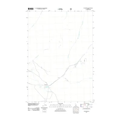
2011 Map of Patterson
USGS Topo · Published 2011About this map
Patterson sits at the junction of Pahsimeroi Rd and Patterson Creek Rd, serving as a focal point for this high-altitude landscape. The settlement is positioned where Patterson Creek emerges into the valley, a geography defined by the drainage systems of Mahogany Creek, Inyo Creek, and Falls Creek. This 2011 survey reveals the enduring industrial footprint of the Ima Mine, located northeast of the townsite along the creek banks. The map provides a detailed view of the local transportation network, including Wallis Ln, which supports the small community. The drainages of the East Fork Patterson Creek and Mill Creek highlight the importance of water management and access in this remote portion of Idaho, where mining history and mountain access routes remain the primary features of the land.
Find a feature on this map
11 named features on this map. Tap any name to fly to it.
Don’t see what you’re looking for? This feature index may not catch every label — zoom into the map to look around manually.
Map Details
Editions of this 2011 Patterson Map
This is the sole edition of this map. No revisions or reprints were ever made.
Other maps of this area

1935 · Borah Peak
USGS Topo · 1:125,000

1938 · Borah Peak
USGS Topo · 1:125,000

1955 · Dubois
USGS Topo · 1:250,000

1956 · Patterson
USGS Topo · 1:62,500

1956 · Donkey Hills
USGS Topo · 1:62,500

1956 · Doublespring
USGS Topo · 1:62,500

1956 · May
USGS Topo · 1:62,500

1958 · Dubois
USGS Topo · 1:250,000

1980 · Leadore
USGS Topo · 1:100,000
1989 · Mogg Mountain
USGS Topo · 1:24,000