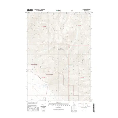
2013 Map of Patterson
USGS Topo · Published 2013About this map
Patterson sits at the foot of the Lemhi Range on this 2013 Idaho survey, where the mountain slopes meet the wide floor of the Pahsimeroi Valley. This area is defined by its dramatic elevation changes, transitioning from the high peaks of the Challis National Forest down to the drainage of Patterson Cr and its tributaries. Local transportation is centered on Pahsimeroi Rd and Wallis Ln, which serve the small settlement and surrounding agricultural lands. The map details the intricate canyon systems carved by Mahogany Cr, E Fork Patterson Cr, and Inyo Cr, illustrating the rugged hydraulic patterns that shape this corner of Lemhi County. These watercourses were foundational to the settlement of this arid valley, providing the necessary resources for ranching and mining operations that have historically characterized the region.
Find a feature on this map
15 named features on this map. Tap any name to fly to it.
Don’t see what you’re looking for? This feature index may not catch every label — zoom into the map to look around manually.
Map Details
Editions of this 2013 Patterson Map
This is the sole edition of this map. No revisions or reprints were ever made.
Other maps of this area

1935 · Borah Peak
USGS Topo · 1:125,000

1938 · Borah Peak
USGS Topo · 1:125,000

1955 · Dubois
USGS Topo · 1:250,000

1956 · Patterson
USGS Topo · 1:62,500

1956 · Donkey Hills
USGS Topo · 1:62,500

1956 · Doublespring
USGS Topo · 1:62,500

1956 · May
USGS Topo · 1:62,500

1958 · Dubois
USGS Topo · 1:250,000

1980 · Leadore
USGS Topo · 1:100,000
1989 · Mogg Mountain
USGS Topo · 1:24,000