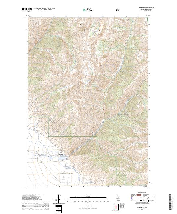
2024 Map of Patterson
USGS Topo · Published 2024About this map
Patterson sits at the foot of the Lemhi Range where the canyon floor opens into the broad Pahsimeroi Valley. This modern survey details the point where mountain hydrology meets valley agriculture, following the course of Patterson Creek as it emerges from the Challis National Forest. The map traces a network of backcountry routes and historical corridors, including the Patterson-Morse Creek Trl and the high-elevation drainage of East Fork Patterson Creek. Further north, Falls Creek and Mahogany Creek carve through the steep terrain of the national forest. Local transit is defined by rural arteries like Pahsimeroi Rd and Patterson Creek Rd, which link the small settlement to the surrounding ranching and forest lands. The contrast between the high peaks and the valley floor illustrates the typical settlement patterns of this part of Idaho.
Find a feature on this map
19 named features on this map. Tap any name to fly to it.
Don’t see what you’re looking for? This feature index may not catch every label — zoom into the map to look around manually.
Map Details
Editions of this 2024 Patterson Map
This is the sole edition of this map. No revisions or reprints were ever made.
Other maps of this area

1935 · Borah Peak
USGS Topo · 1:125,000

1938 · Borah Peak
USGS Topo · 1:125,000

1955 · Dubois
USGS Topo · 1:250,000

1956 · Patterson
USGS Topo · 1:62,500

1956 · Donkey Hills
USGS Topo · 1:62,500

1956 · Doublespring
USGS Topo · 1:62,500

1956 · May
USGS Topo · 1:62,500

1958 · Dubois
USGS Topo · 1:250,000

1980 · Leadore
USGS Topo · 1:100,000
1989 · Mogg Mountain
USGS Topo · 1:24,000