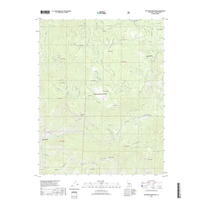
2018 Map of Patterson Mountain
USGS Topo · Published 2018About this map
Balch Camp sits at the base of dramatic elevation shifts within the Sierra National Forest, marking a center of hydroelectric infrastructure along the North Fork Kings River. The landscape is defined by the technical engineering required to harness water power, including the Haas Tunnel, Balch Tunnel, and the high-altitude Black Rock Reservoir. This 2018 survey reveals a complex network of water management features such as the Haas Power House and the Weir Creek Gaging Station, all set against a backdrop of named peaks and ridges. High-country landmarks like Patterson Mountain and Indian Rock overlook significant meadows and clearings, including Sawmill Flat and McKinley Grove. The distribution of these features suggests a landscape deeply utilized for both timber history and modern energy production, while maintaining the wild character of the Sierra Nevada.
Find a feature on this map
101 named features on this map. Tap any name to fly to it.
Don’t see what you’re looking for? This feature index may not catch every label — zoom into the map to look around manually.
Map Details
Editions of this 2018 Patterson Mountain Map
This is the sole edition of this map. No revisions or reprints were ever made.
Other maps of this area

1903 · Tehipite
USGS Topo · 1:125,000

1904 · Kaiser
USGS Topo · 1:125,000

1905 · Tehipite
USGS Topo · 1:125,000

1912 · Mt. Goddard
USGS Topo · 1:125,000

1922 · Trimmer
USGS Topo · 1:96,000

1924 · Dinuba
USGS Topo · 1:125,000

1947 · Mariposa
USGS Topo · 1:250,000

1948 · Fresno
USGS Topo · 1:250,000

1948 · Mariposa
USGS Topo · 1:250,000

1952 · Tehipite Dome
USGS Topo · 1:62,500