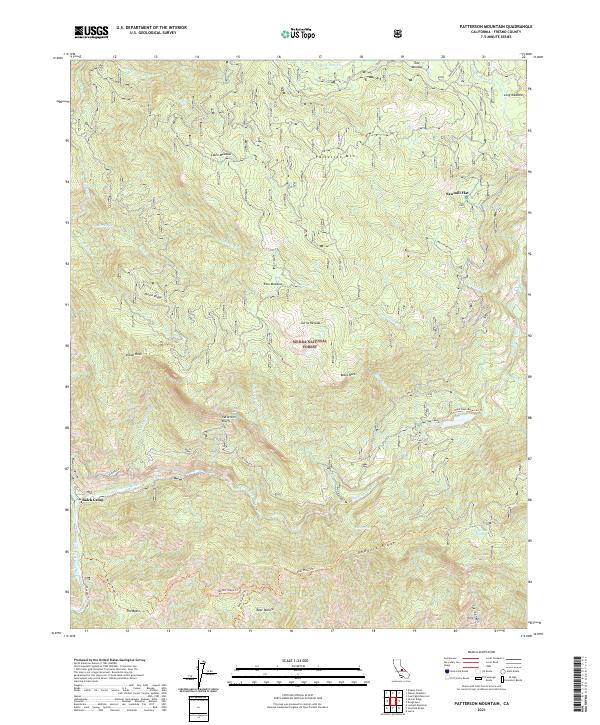
2021 Map of Patterson Mountain
USGS Topo · Published 2021About this map
Sierra Nevada topography dominates this 2021 study of the Sierra National Forest, defined by a series of high ridges and meadows within the Kings River watershed. The N Fork Kings River carves through the southern portion of the quadrangle, where the small settlement of Balch Camp is located at the confluence of several watercourses. This area serves as a significant intersection for forest travel, featuring the Black Rock Reservoir Tr and proximity to the McKinley Grove of giant sequoias just beyond the northeastern ridge.
Find a feature on this map
42 named features on this map. Tap any name to fly to it.
Don’t see what you’re looking for? This feature index may not catch every label — zoom into the map to look around manually.
Map Details
Editions of this 2021 Patterson Mountain Map
This is the sole edition of this map. No revisions or reprints were ever made.
Other maps of this area

1903 · Tehipite
USGS Topo · 1:125,000

1904 · Kaiser
USGS Topo · 1:125,000

1905 · Tehipite
USGS Topo · 1:125,000

1912 · Mt. Goddard
USGS Topo · 1:125,000

1922 · Trimmer
USGS Topo · 1:96,000

1924 · Dinuba
USGS Topo · 1:125,000

1947 · Mariposa
USGS Topo · 1:250,000

1948 · Fresno
USGS Topo · 1:250,000

1948 · Mariposa
USGS Topo · 1:250,000

1952 · Tehipite Dome
USGS Topo · 1:62,500