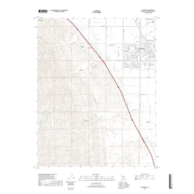
2018 Map of Patterson
USGS Topo · Published 2018About this map
The city of Patterson serves as the focal point of this map, positioned at the edge of the San Joaquin Valley where the flat agricultural basin meets the rising terrain of the Diablo Range. The landscape is defined by massive water infrastructure, most notably the Governor Edmund G. Brown California Aqueduct and the Delta-Mendota Canal, which cut diagonally across the terrain to support the region's intensive irrigation. These engineering works parallel natural drainages like Del Puerto Cr and Salado Cr. Residential expansion is evident in the burgeoning street networks of southern Patterson, while the western portion of the sheet remains dominated by the steep topography of Del Puerto Canyon and Black Gulch. The complex system of irrigation, including the Hirshfield Lateral and Lateral Six S, illustrates the transformation of this arid environment into a productive agricultural hub.
Find a feature on this map
64 named features on this map. Tap any name to fly to it.
Don’t see what you’re looking for? This feature index may not catch every label — zoom into the map to look around manually.
Map Details
Editions of this 2018 Patterson Map
This is the sole edition of this map. No revisions or reprints were ever made.
Other maps of this area

1913 · Romain
USGS Topo · 1:31,680

1915 · Westport
USGS Topo · 1:31,680

1915 · Westley
USGS Topo · 1:31,680

1916 · Crows Landing
USGS Topo · 1:31,680

1916 · Patterson
USGS Topo · 1:31,680

1916 · Romain
USGS Topo · 1:31,680

1917 · Newman
USGS Topo · 1:31,680

1919 · Orestimba
USGS Topo · 1:62,500

1919 · Orestimba Creek
USGS Topo · 1:31,680

1922 · Carbona
USGS Topo · 1:62,500