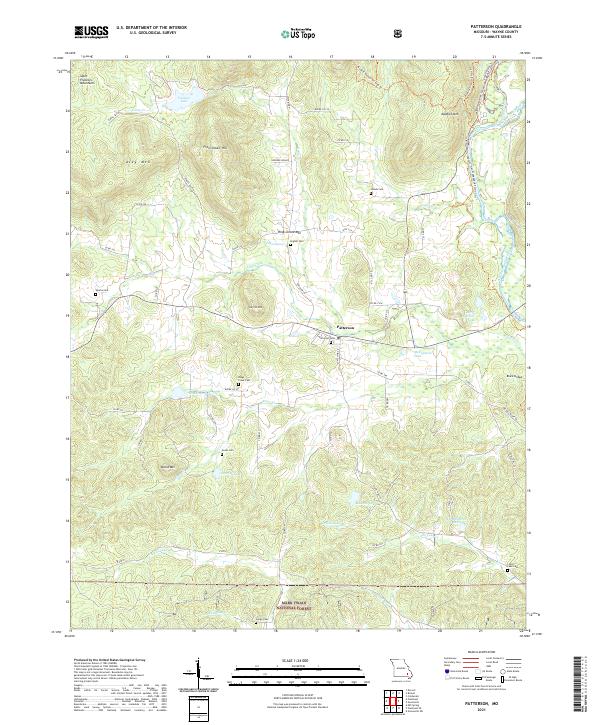
2021 Map of Patterson
USGS Topo · Published 2021About this map
Patterson serves as the central hub of this eastern Ozark landscape, where the southern reaches of the Saint Francois Mountains meet the valley of the Saint Francis River. This 2021 survey illustrates a region defined by its rugged topography and water resources, including numerous private and public impoundments like Mountain Lake, Sunrise Lake, and Frontier Lake. The intricate network of county roads, such as Co RD 324 and Wayne Co 332, connects scattered family settlements and several burial grounds, including English Cem, Sparks Cem, and Jones Cem, which are vital for genealogical research in Wayne County.
Find a feature on this map
74 named features on this map. Tap any name to fly to it.
Don’t see what you’re looking for? This feature index may not catch every label — zoom into the map to look around manually.
Map Details
Editions of this 2021 Patterson Map
This is the sole edition of this map. No revisions or reprints were ever made.
Other maps of this area

1926 · Des Arc
USGS Topo · 1:62,500

1929 · Des Arc
USGS Topo · 1:62,500

1930 · Coldwater
USGS Topo · 1:62,500

1932 · Piedmont
USGS Topo · 1:62,500

1934 · Greenville
USGS Topo · 1:62,500

1935 · Piedmont
USGS Topo · 1:62,500

1939 · Greenville
USGS Topo · 1:62,500

1949 · Rolla
USGS Topo · 1:250,000

1949 · Coldwater
USGS Topo · 1:62,500

1953 · Rolla
USGS Topo · 1:250,000