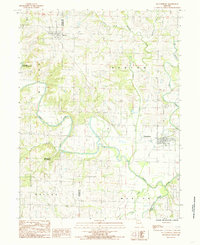
1984 Map of Pattonsburg
USGS Topo · Published 1985About this map
Pattonsburg and McFall anchor this mid-1980s topographical study of northwest Missouri, where the meandering Grand River carves deep loops across the landscape. The geography is defined by a dense network of watercourses, including Sampson Creek, Big Creek, and Grindstone Creek, which historically dictated the settlement patterns and road networks of Daviess, Gentry, and DeKalb counties.
Find a feature on this map
20 named features on this map. Tap any name to fly to it.
Don’t see what you’re looking for? This feature index may not catch every label — zoom into the map to look around manually.
Map Details
Editions of this 1984 Pattonsburg Map
This is the sole edition of this map. No revisions or reprints were ever made.
Other maps of this area

1923 · Maysville
USGS Topo · 1:62,500

1924 · Winston
USGS Topo · 1:62,500

1925 · Pattonsburg
USGS Topo · 1:62,500

1925 · Maysville
USGS Topo · 1:62,500

1925 · Darlington
USGS Topo · 1:62,500

1944 · Pattonsburg
USGS Topo · 1:62,500

1946 · Pattonsburg
USGS Topo · 1:48,000

1948 · Pattonsburg
USGS Topo · 1:62,500

1950 · Kansas City
USGS Topo · 1:250,000

1950 · Darlington
USGS Topo · 1:62,500