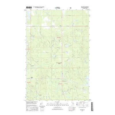
2017 Map of Paulding
USGS Topo · Published 2017About this map
The Ottawa National Forest dominates this landscape in Haight Township, where the Middle Br Ontonagon River and its numerous tributaries, including Bluff Creek and Sucker Creek, carve through the Upper Peninsula. The small settlement of Paulding serves as a local hub near Paulding Pond, while to the southwest lies the community of Robbins near Robbins Pond. The map reveals a high density of water features and elevation changes, notably Himanka Hill in the north and the significant reservoir of the Bond Falls Flowage. Genealogists may find interest in the Maple Grove Cem and Barclay Cem, which sit alongside historic road corridors. This 2017 survey reflects the area's continued character as a timber and water resource region, with a complex network of forest service roads like Nfst-5444 supporting the local economy and forest management efforts.
Find a feature on this map
76 named features on this map. Tap any name to fly to it.
Don’t see what you’re looking for? This feature index may not catch every label — zoom into the map to look around manually.
Map Details
Editions of this 2017 Paulding Map
This is the sole edition of this map. No revisions or reprints were ever made.
Other maps of this area

1949 · Rockland
USGS Topo · 1:62,500

1951 · Rockland
USGS Topo · 1:62,500

1952 · Watersmeet
USGS Topo · 1:62,500

1952 · Thayer
USGS Topo · 1:62,500

1956 · Matchwood
USGS Topo · 1:62,500

1958 · Iron River
USGS Topo · 1:250,000

1960 · Iron River
USGS Topo · 1:250,000

1961 · Iron River
USGS Topo · 1:250,000

1967 · Iron River
USGS Topo · 1:250,000

1979 · Ontonagon
USGS Topo · 1:100,000