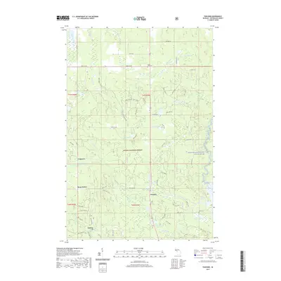
2019 Map of Paulding
USGS Topo · Published 2019About this map
Ottawa National Forest encompasses most of this Upper Peninsula landscape, where the settlements of Paulding, Robbins, and Craigsmere are linked by a network of forest highways and historic local routes. The area is defined by its complex drainage systems, including the Baltimore River and the protected Ontonagon Wild and Scenic River corridor on the eastern edge. For genealogists and local historians, the presence of the Maple Grove Cem near Maple Grove Cem and Barclay Cem near Barclay Pond provides specific points of interest for family research. The terrain is a mosaic of wetlands and small lakes such as Tanlund Lake and Erickson Lake, with Himanka Hill rising as a notable landmark. This modern survey documents the legacy of these timber-era settlements as they exist within the federal forest boundaries today.
Find a feature on this map
46 named features on this map. Tap any name to fly to it.
Don’t see what you’re looking for? This feature index may not catch every label — zoom into the map to look around manually.
Map Details
Editions of this 2019 Paulding Map
This is the sole edition of this map. No revisions or reprints were ever made.
Other maps of this area

1949 · Rockland
USGS Topo · 1:62,500

1951 · Rockland
USGS Topo · 1:62,500

1952 · Watersmeet
USGS Topo · 1:62,500

1952 · Thayer
USGS Topo · 1:62,500

1956 · Matchwood
USGS Topo · 1:62,500

1958 · Iron River
USGS Topo · 1:250,000

1960 · Iron River
USGS Topo · 1:250,000

1961 · Iron River
USGS Topo · 1:250,000

1967 · Iron River
USGS Topo · 1:250,000

1979 · Ontonagon
USGS Topo · 1:100,000