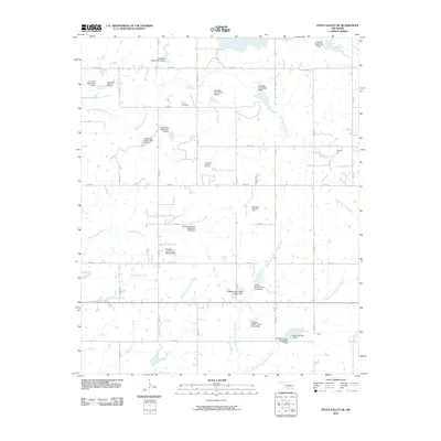
2010 Map of Pauls Valley NE
USGS Topo · Published 2010About this map
Lewis Cemetery sits at the heart of this Garvin County landscape, marking a point of repose amidst a highly active petroleum and water-management corridor. The territory is defined by its industrial footprint, featuring extensive operations such as the East Pauls Valley Oil Field, Northeast Nahola Oil Field, and the Southwest Lewis Oil Field. These energy resources are overlaid by a complex drainage system, where the naturally winding courses of Cherokee Sandy Creek and Turkey Sandy Creek are punctuated by numerous flood control structures. A series of engineered embankments, including Cherokee Sandy Site 8 Dam and Chigley Sandy Creek Site 6 Dam, demonstrate the region's 21st-century efforts to manage the watershed of the West Branch Chigley Sandy Creek and its tributaries while maintaining a network of rural section-line roads.
Find a feature on this map
39 named features on this map. Tap any name to fly to it.
Don’t see what you’re looking for? This feature index may not catch every label — zoom into the map to look around manually.
Map Details
Editions of this 2010 Pauls Valley NE Map
This is the sole edition of this map. No revisions or reprints were ever made.
Other maps of this area

1898 · Pauls Valley
USGS Topo · 1:125,000

1901 · Stonewall
USGS Topo · 1:125,000

1902 · Pauls Valley
USGS Topo · 1:125,000

1957 · Ardmore
USGS Topo · 1:250,000

1963 · Ardmore
USGS Topo · 1:250,000

1964 · Byars
USGS Topo · 1:24,000

1965 · Pauls Valley NE
USGS Topo · 1:24,000

1965 · Byars SW
USGS Topo · 1:24,000

1965 · Pauls Valley
USGS Topo · 1:24,000

1965 · Davis
USGS Topo · 1:24,000