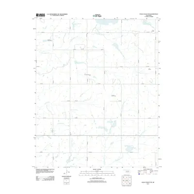
2012 Map of Pauls Valley NE
USGS Topo · Published 2012About this map
The Oklahoma oil industry shapes this 2012 survey, with the East Pauls Valley Oil Field, Northeast Nahola Oil Field, and the Lewis Oil Field scattered across the northern landscape. These extractive sites coexist with a complex network of flood control and agricultural reservoirs, notably the Cherokee Sandy Site 14 Reservoir and multiple basins along Chigley Sandy Creek. The terrain is defined by a dense drainage system including Willow Sandy Cr and Kickapoo Sandy Cr, providing water to this rural expanse.
Find a feature on this map
36 named features on this map. Tap any name to fly to it.
Don’t see what you’re looking for? This feature index may not catch every label — zoom into the map to look around manually.
Map Details
Editions of this 2012 Pauls Valley NE Map
This is the sole edition of this map. No revisions or reprints were ever made.
Other maps of this area

1898 · Pauls Valley
USGS Topo · 1:125,000

1901 · Stonewall
USGS Topo · 1:125,000

1902 · Pauls Valley
USGS Topo · 1:125,000

1957 · Ardmore
USGS Topo · 1:250,000

1963 · Ardmore
USGS Topo · 1:250,000

1964 · Byars
USGS Topo · 1:24,000

1965 · Pauls Valley NE
USGS Topo · 1:24,000

1965 · Byars SW
USGS Topo · 1:24,000

1965 · Pauls Valley
USGS Topo · 1:24,000

1965 · Davis
USGS Topo · 1:24,000