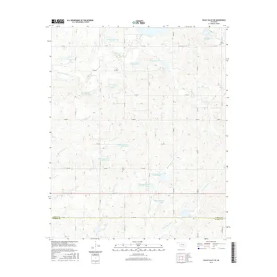
2016 Map of Pauls Valley NE
USGS Topo · Published 2016About this map
Sandy Hill Cem and Lewis Cem sit among the northern hills of this region, which is defined by an extensive network of water management sites. The landscape is characterized by numerous flood control structures, including Cherokee Sandy Site 1 Reservoir and several others numbered across the Cherokee Sandy Cr and Kickapoo Sandy Cr drainages. These reservoirs, such as Kickapoo Sandy Creek Site N3a Reservoir, illustrate the mid-20th-century hydraulic engineering efforts to stabilize the watershed. Further south, near the boundary of Garvin Co and Murray Co, the terrain transitions toward the Chigley Sandy Creek system. Along Co Line Rd, one finds Oak Grove Cem and the Rock Creek Site 1 Reservoir, markers of long-standing rural community centers in a landscape dominated by ranching and small-scale agriculture.
Find a feature on this map
32 named features on this map. Tap any name to fly to it.
Don’t see what you’re looking for? This feature index may not catch every label — zoom into the map to look around manually.
Map Details
Editions of this 2016 Pauls Valley NE Map
This is the sole edition of this map. No revisions or reprints were ever made.
Other maps of this area

1898 · Pauls Valley
USGS Topo · 1:125,000

1901 · Stonewall
USGS Topo · 1:125,000

1902 · Pauls Valley
USGS Topo · 1:125,000

1957 · Ardmore
USGS Topo · 1:250,000

1963 · Ardmore
USGS Topo · 1:250,000

1964 · Byars
USGS Topo · 1:24,000

1965 · Pauls Valley NE
USGS Topo · 1:24,000

1965 · Byars SW
USGS Topo · 1:24,000

1965 · Pauls Valley
USGS Topo · 1:24,000

1965 · Davis
USGS Topo · 1:24,000