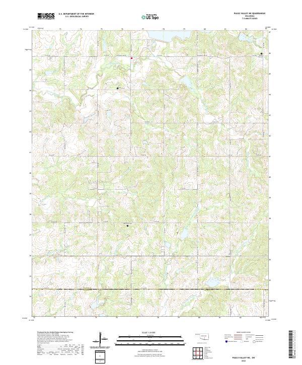
2022 Map of Pauls Valley NE
USGS Topo · Published 2022About this map
The boundary between Garvin and Murray counties cuts across this landscape, where the local terrain is defined by a complex network of sandy creeks. Waterways such as Cherokee Sandy Creek and Kickapoo Sandy Creek drain the area, while smaller branches like W Br Chigley Sandy Creek and E Br Chigley Sandy Creek converge in the southern reaches. These drainage patterns influenced the early settlement and road placement throughout the township sections.
Find a feature on this map
39 named features on this map. Tap any name to fly to it.
Don’t see what you’re looking for? This feature index may not catch every label — zoom into the map to look around manually.
Map Details
Editions of this 2022 Pauls Valley NE Map
This is the sole edition of this map. No revisions or reprints were ever made.
Other maps of this area

1898 · Pauls Valley
USGS Topo · 1:125,000

1901 · Stonewall
USGS Topo · 1:125,000

1902 · Pauls Valley
USGS Topo · 1:125,000

1957 · Ardmore
USGS Topo · 1:250,000

1963 · Ardmore
USGS Topo · 1:250,000

1964 · Byars
USGS Topo · 1:24,000

1965 · Pauls Valley NE
USGS Topo · 1:24,000

1965 · Byars SW
USGS Topo · 1:24,000

1965 · Pauls Valley
USGS Topo · 1:24,000

1965 · Davis
USGS Topo · 1:24,000