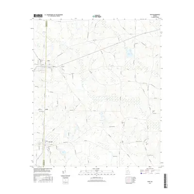
2017 Map of Pavo
USGS Topo · Published 2017About this map
Pavo and Barwick straddle the boundary between Thomas County and Brooks County, anchoring a landscape of agricultural roads and scattered family cemeteries. The town of Pavo is defined by its grid of streets such as Harris St and Pear St, while the small settlement of Hollis lies further south. This region is punctuated by numerous small water bodies and wetlands, including Lake Nichols, Bryan Lake, and Lake Pope, which drain into systems like Mule Creek and Dry Lake Creek.
Find a feature on this map
89 named features on this map. Tap any name to fly to it.
Don’t see what you’re looking for? This feature index may not catch every label — zoom into the map to look around manually.
Map Details
Editions of this 2017 Pavo Map
This is the sole edition of this map. No revisions or reprints were ever made.
Other maps of this area

1953 · Waycross
USGS Topo · 1:250,000

1954 · Valdosta
USGS Topo · 1:250,000

1957 · Thomasville
USGS Topo · 1:62,500

1958 · Valdosta
USGS Topo · 1:250,000

1958 · Waycross
USGS Topo · 1:250,000

1959 · Valdosta
USGS Topo · 1:250,000

1961 · Quitman
USGS Topo · 1:62,500

1974 · Berlin East
USGS Topo · 1:24,000
1974 · Quitman
USGS Topo · 1:24,000
1975 · Pebble Hill
USGS Topo · 1:24,000