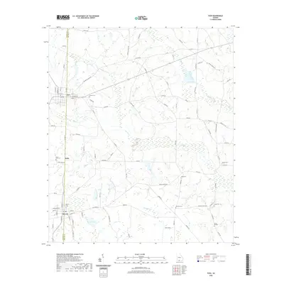
2020 Map of Pavo
USGS Topo · Published 2020About this map
Pavo and Barwick anchor this agricultural landscape along the Thomas and Brooks county line in southern Georgia. The map reveals a highly developed network of rural routes such as Old Pavo Rd and Coffee Rd, which intersect the small settlement of Hollis. These roads connect numerous family and community landmarks, particularly a high density of rural burial grounds including Lebanon Cem, Hodges Cem, and Oak Grove Cem.
Find a feature on this map
85 named features on this map. Tap any name to fly to it.
Don’t see what you’re looking for? This feature index may not catch every label — zoom into the map to look around manually.
Map Details
Editions of this 2020 Pavo Map
This is the sole edition of this map. No revisions or reprints were ever made.
Other maps of this area

1953 · Waycross
USGS Topo · 1:250,000

1954 · Valdosta
USGS Topo · 1:250,000

1957 · Thomasville
USGS Topo · 1:62,500

1958 · Valdosta
USGS Topo · 1:250,000

1958 · Waycross
USGS Topo · 1:250,000

1959 · Valdosta
USGS Topo · 1:250,000

1961 · Quitman
USGS Topo · 1:62,500

1974 · Berlin East
USGS Topo · 1:24,000
1974 · Quitman
USGS Topo · 1:24,000
1975 · Pebble Hill
USGS Topo · 1:24,000