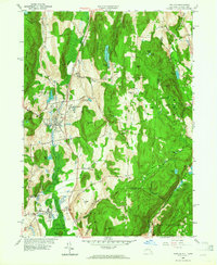
1958 Map of Pawling
USGS Topo · Published 1964About this map
The New York Central railroad corridor serves as the primary artery through this mid-century landscape, linking the established village of Pawling with the southern hamlet of Patterson. The terrain is defined by the significant wetland of The Great Swamp, which dominates the valley floor between the rising elevations of Hammersly Ridge and Quaker Hill. This survey captures a mix of academic, religious, and agricultural history, featuring the Trinity-Pawling Sch campus and the historic Meeting House near the Connecticut border.
Find a feature on this map
62 named features on this map. Tap any name to fly to it.
Don’t see what you’re looking for? This feature index may not catch every label — zoom into the map to look around manually.
Map Details
Editions of this 1958 Pawling Map
4 editions found
Other maps of this area

1892 · Danbury
USGS Topo · 1:62,500

1892 · New Milford
USGS Topo · 1:62,500

1892 · Carmel
USGS Topo · 1:62,500

1893 · Carmel
USGS Topo · 1:62,500

1893 · New Milford
USGS Topo · 1:62,500

1893 · Clove
USGS Topo · 1:62,500

1894 · Clove
USGS Topo · 1:62,500

1894 · Carmel
USGS Topo · 1:62,500

1898 · Clove
USGS Topo · 1:62,500

1901 · Clove
USGS Topo · 1:62,500