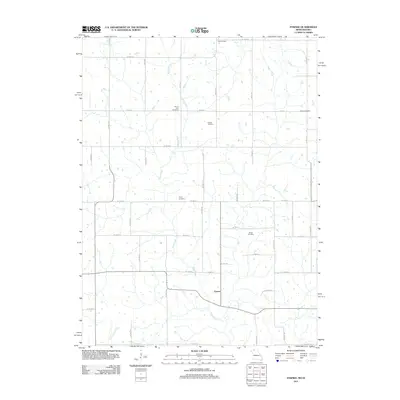
2011 Map of Pawnee
USGS Topo · Published 2011About this map
Pawnee and the northern settlement of Bloomington anchor this rural landscape in a region defined by its branching drainage networks. The terrain is deeply inscribed by the southward flow of Wolf Creek, which meanders through the center of the sheet, and the headwaters of Little Creek in the southwest. For genealogists and local historians, the distribution of burial grounds across the countryside reveals the long-standing family foundations of the area, including Mount Zion Cemetery, Patrick Cemetery, and Hollen Cemetery. A grid of county roads and local avenues, such as Co HWY-j55 and Co HWY-j67, connects these small communities and rural sites, providing a clear view of the twentieth-century transportation infrastructure that still serves this agricultural pocket on the Missouri-Iowa border.
Find a feature on this map
40 named features on this map. Tap any name to fly to it.
Don’t see what you’re looking for? This feature index may not catch every label — zoom into the map to look around manually.
Map Details
Editions of this 2011 Pawnee Map
This is the sole edition of this map. No revisions or reprints were ever made.
Other maps of this area

1945 · Mount Ayr
USGS Topo · 1:62,500

1945 · Lamoni
USGS Topo · 1:62,500

1947 · Lamoni
USGS Topo · 1:62,500

1947 · Blythedale
USGS Topo · 1:62,500

1947 · Mount Ayr
USGS Topo · 1:62,500

1948 · Bethany
USGS Topo · 1:62,500

1954 · Centerville
USGS Topo · 1:250,000

1955 · Nebraska City
USGS Topo · 1:250,000

1957 · Nebraska City
USGS Topo · 1:250,000

1957 · Centerville
USGS Topo · 1:250,000