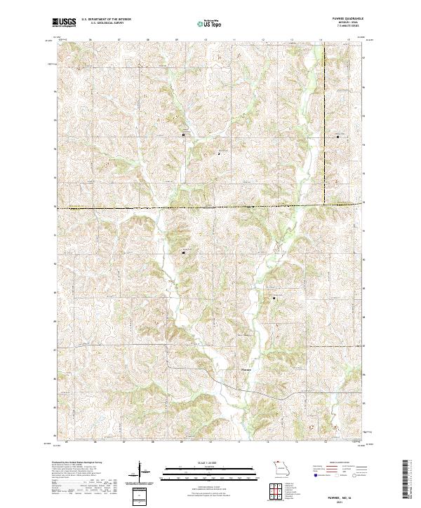
2021 Map of Pawnee
USGS Topo · Published 2021About this map
Pawnee sits at the heart of this survey of the Missouri-Iowa borderlands, where the north-south section lines of Harrison and Decatur Counties meet the rolling drainage of the W Fork Big Cr and Wolf Cr. The landscape is defined by its rural cemetery network, which serves as a vital record for family historians tracing early settlers in these townships. Sites such as Mount Zion Cem, Patrick Cem, and Hollen Cem are spaced across the northern half of the quadrangle, reflecting the early patterns of community burial grounds. To the south, the terrain becomes increasingly carved by Shain Cr and Little Cr. This contemporary topographic record captures the grid-like road system, from county routes like Co RD j55 to local connectors such as W 150th ST, which continue to define the agricultural rhythm of the border region.
Find a feature on this map
42 named features on this map. Tap any name to fly to it.
Don’t see what you’re looking for? This feature index may not catch every label — zoom into the map to look around manually.
Map Details
Editions of this 2021 Pawnee Map
This is the sole edition of this map. No revisions or reprints were ever made.
Other maps of this area

1945 · Mount Ayr
USGS Topo · 1:62,500

1945 · Lamoni
USGS Topo · 1:62,500

1947 · Lamoni
USGS Topo · 1:62,500

1947 · Blythedale
USGS Topo · 1:62,500

1947 · Mount Ayr
USGS Topo · 1:62,500

1948 · Bethany
USGS Topo · 1:62,500

1954 · Centerville
USGS Topo · 1:250,000

1955 · Nebraska City
USGS Topo · 1:250,000

1957 · Nebraska City
USGS Topo · 1:250,000

1957 · Centerville
USGS Topo · 1:250,000