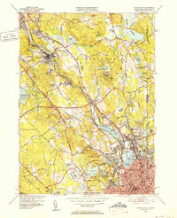
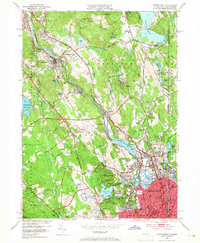
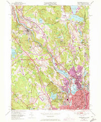
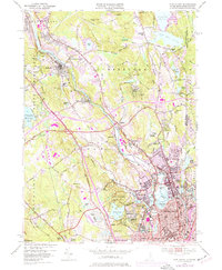
1949 Map of Pawtucket
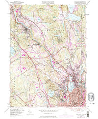
USGS Topo · Published 1977About this map
The Blackstone River corridor serves as the industrial and geographic spine of this Rhode Island and Massachusetts borderlands study, illustrating the dense 20th-century development between Woonsocket and Pawtucket. This post-war update highlights the conversion of land use, where the historic Blackstone Canal and Providence and Worcester RR line the valley floor near textile-era villages like Manville and Lonsdale. Away from the river, the map reveals significant open-space and institutional footprints, including the sprawling Lincoln Woods State Park and the Cistercian Monastery near Berkeley. Genealogists and local historians can find essential details in the numerous burial sites, such as the Polish Cem and Moshassuck Cem, alongside mid-century landmarks like the North Central State Airport and Lincoln Downs.
Find a feature on this map
105 named features on this map. Tap any name to fly to it.
Don’t see what you’re looking for? This feature index may not catch every label — zoom into the map to look around manually.
Map Details
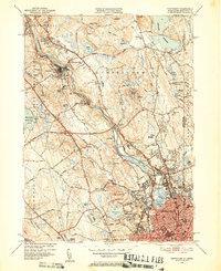
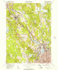
Editions of this 1949 Pawtucket Map
7 editions found
Other maps of this area

1886 · Blackstone
USGS Topo · 1:62,500

1887 · Franklin
USGS Topo · 1:62,500

1887 · Providence
USGS Topo · 1:62,500

1889 · Providence
USGS Topo · 1:62,500

1889 · Blackstone
USGS Topo · 1:62,500

1889 · Franklin
USGS Topo · 1:62,500

1889 · Burrillville
USGS Topo · 1:62,500

1893 · Franklin
USGS Topo · 1:62,500

1893 · Blackstone
USGS Topo · 1:62,500

1894 · Burrillville
USGS Topo · 1:62,500