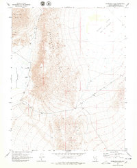
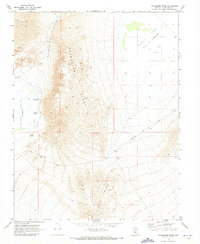
1970 Map of Paymaster Ridge
USGS Topo · Published 1979About this map
Paymaster Ridge and Clayton Ridge define the desert relief of this Esmeralda County landscape, captured during a 1970 field check. The area is characterized by significant natural water features and depressions, most notably the thermal Pearl Hot Springs and the nearby Twin Springs situated along the edge of the Clayton Valley. To the northeast, the broad Alkali Lake basin sits as a prominent sink, while the western reaches are marked by the Weepah Hills and the winding Paymaster Canyon. Human activity in this arid environment is evidenced by several scattered prospects and a network of primitive tracks including Salt Road, Pearl Road, and the arterial Silver Peak Road. The map provides a clear look at the geological and hydrological markers that once guided prospectors and travelers through this part of the Nevada desert.
Find a feature on this map
17 named features on this map. Tap any name to fly to it.
Don’t see what you’re looking for? This feature index may not catch every label — zoom into the map to look around manually.
Map Details
Editions of this 1970 Paymaster Ridge Map
2 editions found
Other maps of this area

1898 · Silver Peak
USGS Topo · 1:125,000

1900 · Silver Peak
USGS Topo · 1:125,000

1908 · Lida
USGS Topo · 1:250,000

1913 · Lida
USGS Topo · 1:250,000
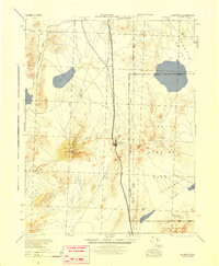
1945 · Goldfield
USGS Topo · 1:125,000

1954 · Goldfield
USGS Topo · 1:250,000

1955 · Goldfield
USGS Topo · 1:250,000

1958 · Goldfield
USGS Topo · 1:250,000

1962 · Goldfield
USGS Topo · 1:250,000
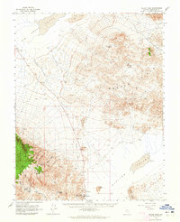
1963 · Silver Peak
USGS Topo · 1:62,500