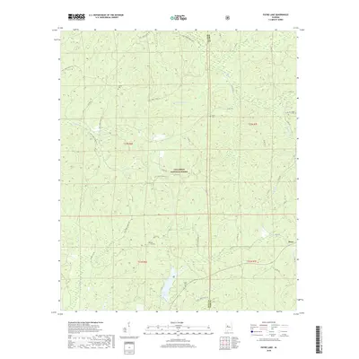
2018 Map of Payne Lake
USGS Topo · Published 2018About this map
Talladega National Forest dominates this section of the Alabama landscape, where the border of Hale and Bibb counties runs through a network of small creeks and forest service roads. The area is defined by its water system, including Payne Lake and the winding paths of Elliotts Cr, Fivemile Cr, and the appropriately named Troublesome Br. These drainages have historically shaped the settlement patterns of this rural region, which remained sparsely populated into the 21st century.
Find a feature on this map
25 named features on this map. Tap any name to fly to it.
Don’t see what you’re looking for? This feature index may not catch every label — zoom into the map to look around manually.
Map Details
Editions of this 2018 Payne Lake Map
This is the sole edition of this map. No revisions or reprints were ever made.
Other maps of this area

1899 · Brookwood
USGS Topo · 1:125,000

1924 · Tuscaloosa
USGS Topo · 1:62,500

1926 · Tuscaloosa
USGS Topo · 1:62,500

1931 · Cottondale
USGS Topo · 1:48,000

1934 · Cottondale
USGS Topo · 1:62,500

1953 · Montgomery
USGS Topo · 1:250,000

1953 · Birmingham
USGS Topo · 1:250,000

1956 · Birmingham
USGS Topo · 1:250,000

1956 · Montgomery
USGS Topo · 1:250,000

1957 · Birmingham
USGS Topo · 1:250,000