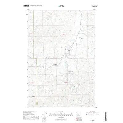
2020 Map of Pe Ell
USGS Topo · Published 2020About this map
Pe Ell serves as the central hub of this landscape, situated where the Chehalis River winds through the Pe Ell Prairie. The town’s grid is clearly defined by streets like Main St and E Pe Ell Ave, with the Forest Lawn Cem located just to the southwest. The route of the Willapa Hills State Park Trail provides a continuous thread through the map, following the path of former rail infrastructure past the smaller settlements of McCormick and Walville.
Find a feature on this map
62 named features on this map. Tap any name to fly to it.
Don’t see what you’re looking for? This feature index may not catch every label — zoom into the map to look around manually.
Map Details
Editions of this 2020 Pe Ell Map
This is the sole edition of this map. No revisions or reprints were ever made.
Other maps of this area

1941 · Walville
USGS Topo · 1:62,500

1941 · Meskill
USGS Topo · 1:62,500

1941 · Skamokawa
USGS Topo · 1:62,500

1953 · Hoquiam
USGS Topo · 1:250,000

1953 · Ryderwood
USGS Topo · 1:62,500

1953 · Skamokawa
USGS Topo · 1:62,500

1953 · Pe Ell
USGS Topo · 1:62,500

1953 · Adna
USGS Topo · 1:62,500

1957 · Hoquiam
USGS Topo · 1:250,000

1958 · Hoquiam
USGS Topo · 1:250,000