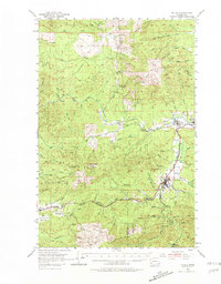
1953 Map of Pe Ell
USGS Topo · Published 1981About this map
Pe Ell serves as a central hub on this mid-century survey, where the Northern Pacific railroad follows the winding path of the Chehalis River. This industrial and logging landscape is defined by its transit networks, including the Milwaukee Road and the Chicago Milwaukee St Paul and Pacific lines that link timber-adjacent settlements like Doty, Dryad, and Walville. The map captures an era of active mountain industry, indicated by multiple Quarry sites and an Old Railroad Grade winding through the hills near Fall River. Local heritage is anchored by landmarks such as the Sylvan Cem and prominent elevations like Welville Peak and Huckleberry Ridge. The intricate drainage systems of Lincoln Creek and Seven Creek reveal the complex topography of the Pacific and Lewis County border region, illustrating the difficult terrain navigated by early twentieth-century rail engineers.
Find a feature on this map
71 named features on this map. Tap any name to fly to it.
Don’t see what you’re looking for? This feature index may not catch every label — zoom into the map to look around manually.
Map Details
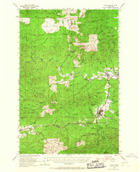
Editions of this 1953 Pe Ell Map
3 editions found

Other maps of this area

1940 · Montesano
USGS Topo · 1:62,500

1940 · Brookfield
USGS Topo · 1:62,500

1941 · Walville
USGS Topo · 1:62,500

1941 · Meskill
USGS Topo · 1:62,500

1941 · Gate
USGS Topo · 1:62,500

1941 · Skamokawa
USGS Topo · 1:62,500

1941 · Ford
USGS Topo · 1:62,500

1953 · Hoquiam
USGS Topo · 1:250,000

1953 · Ryderwood
USGS Topo · 1:62,500

1953 · Rochester
USGS Topo · 1:62,500