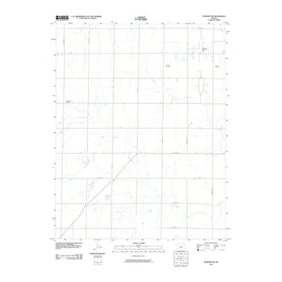
2010 Map of Peabody NW
USGS Topo · Published 2010About this map
Doyle Creek meanders through this agricultural landscape in northeastern Harvey County, joined by several smaller tributaries including Spring Creek and the West Branch Whitewater Creek. The terrain is characterized by a strict section-line road grid, featuring thoroughfares such as Goldenrod Rd, Jade Rd, and NW 108th St. This 2010 survey illustrates the intersection of rural heritage and industrial activity, notably preserved through the Dunkard Cemetery, Catlin Cemetery, and Doyle Valley Cemetery. The presence of the Southwest Unger Oil Field in the northern portion of the map indicates the local economic importance of mineral extraction alongside traditional farming. These landmarks provide essential points of reference for those researching family history or the evolving land-use patterns of the Kansas plains.
Find a feature on this map
22 named features on this map. Tap any name to fly to it.
Don’t see what you’re looking for? This feature index may not catch every label — zoom into the map to look around manually.
Map Details
Editions of this 2010 Peabody NW Map
This is the sole edition of this map. No revisions or reprints were ever made.
Other maps of this area

1889 · Newton
USGS Topo · 1:125,000

1894 · Newton
USGS Topo · 1:125,000

1955 · Hutchinson
USGS Topo · 1:250,000

1957 · Newton
USGS Topo · 1:24,000

1957 · Peabody NW
USGS Topo · 1:24,000

1957 · Peabody
USGS Topo · 1:24,000

1957 · Elbing
USGS Topo · 1:24,000

1959 · Hutchinson
USGS Topo · 1:250,000
1962 · Peabody SE
USGS Topo · 1:24,000

1965 · Goessel
USGS Topo · 1:24,000