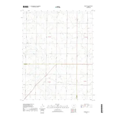
2018 Map of Peabody NW
USGS Topo · Published 2018About this map
Dunkard Cem and Catlin Cem sit within the high plains of the Kansas interior, marking the rural heritage of the borderlands between Marion and Harvey counties. This landscape is defined by the headwaters and drainages of several regional watercourses, including the winding path of Doyle Cr and Antelope Cr. The map reveals a strictly regulated section-line road grid, such as Goldenrod Rd and Mustang Rd, which segments the agricultural terrain into precise geometric tracts. Small burial sites like Doyle Valley Cem are the primary landmarks in this sparsely settled area, serving as vital points of reference for genealogists tracing early families in the region. The drainage patterns of W Br Whitewater Cr and Spring Cr illustrate the subtle relief that dictates the placement of farmsteads and rural infrastructure in this central Kansas quadrangle.
Find a feature on this map
47 named features on this map. Tap any name to fly to it.
Don’t see what you’re looking for? This feature index may not catch every label — zoom into the map to look around manually.
Map Details
Editions of this 2018 Peabody NW Map
This is the sole edition of this map. No revisions or reprints were ever made.
Other maps of this area

1889 · Newton
USGS Topo · 1:125,000

1894 · Newton
USGS Topo · 1:125,000

1955 · Hutchinson
USGS Topo · 1:250,000

1957 · Newton
USGS Topo · 1:24,000

1957 · Peabody NW
USGS Topo · 1:24,000

1957 · Peabody
USGS Topo · 1:24,000

1957 · Elbing
USGS Topo · 1:24,000

1959 · Hutchinson
USGS Topo · 1:250,000
1962 · Peabody SE
USGS Topo · 1:24,000

1965 · Goessel
USGS Topo · 1:24,000