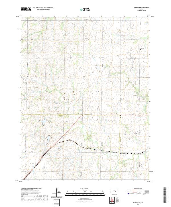
2022 Map of Peabody NW
USGS Topo · Published 2022About this map
Dunkard Cem and Catlin Cem sit atop the prairie uplands of the Kansas Flint Hills region, marking the early settlement history of this agricultural landscape. The terrain is defined by a dense network of watercourses that drain the divide between the Marion and Harvey County line, including the headwaters of Antelope Cr and Doyle Cr. This 2022 survey illustrates the enduring section-line road grid that has structured life here for generations, with routes like Mustang Rd and Indigo Rd providing access to isolated farmsteads and burial grounds such as the Doyle Valley Cem. The map reveals how the subtle topography dictates the flow of several tributaries, including Spring Cr and the W Br Whitewater Cr, creating a landscape where water and road networks are the primary markers of human presence.
Find a feature on this map
43 named features on this map. Tap any name to fly to it.
Don’t see what you’re looking for? This feature index may not catch every label — zoom into the map to look around manually.
Map Details
Editions of this 2022 Peabody NW Map
This is the sole edition of this map. No revisions or reprints were ever made.
Other maps of this area

1889 · Newton
USGS Topo · 1:125,000

1894 · Newton
USGS Topo · 1:125,000

1955 · Hutchinson
USGS Topo · 1:250,000

1957 · Newton
USGS Topo · 1:24,000

1957 · Peabody NW
USGS Topo · 1:24,000

1957 · Peabody
USGS Topo · 1:24,000

1957 · Elbing
USGS Topo · 1:24,000

1959 · Hutchinson
USGS Topo · 1:250,000
1962 · Peabody SE
USGS Topo · 1:24,000

1965 · Goessel
USGS Topo · 1:24,000