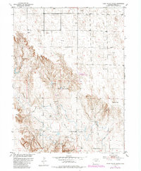
1951 Map of Peace Valley School
USGS Topo · Published 1984About this map
Peace Valley School stands as a focal point in this 1951 study of the Morgan County landscape, situated amidst a network of canyons and livestock infrastructure. The terrain is defined by the drainage systems of Wildcat Creek and Rock Spring Draw, where a series of small-scale water management projects like Mason Dam and Box Canyon Dam illustrate the local efforts to harness seasonal flows. The presence of the Jackpot Ditch (Aband) suggests an evolving relationship with the land as early irrigation attempts were superseded by other methods of water control.
Find a feature on this map
20 named features on this map. Tap any name to fly to it.
Don’t see what you’re looking for? This feature index may not catch every label — zoom into the map to look around manually.
Map Details
Editions of this 1951 Peace Valley School Map
2 editions found
Other maps of this area

1951 · Weldona
USGS Topo · 1:24,000

1951 · Dead Horse Springs
USGS Topo · 1:24,000

1951 · Brush West
USGS Topo · 1:24,000

1951 · Peace Valley School
USGS Topo · 1:24,000

1951 · Judson Hills
USGS Topo · 1:24,000

1951 · Fort Morgan
USGS Topo · 1:24,000

1954 · Sterling
USGS Topo · 1:250,000

1958 · Sterling
USGS Topo · 1:250,000
1971 · Brush West
USGS Topo · 1:24,000
1971 · Fort Morgan
USGS Topo · 1:24,000