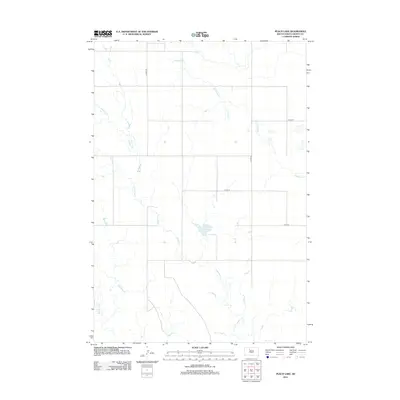
2012 Map of Peach Lake
USGS Topo · Published 2012About this map
Peach Lake sits at the center of this sparse rangeland landscape in Dewey and Ziebach Counties, serving as a primary water source for this section of the Great Plains. The hydrology of the region is defined by the winding paths of Redwater Cr and Meadow Cr, which create a complex drainage network across the prairie. Small seasonal tributaries like Red Earth Cr further illustrate the importance of water management in this arid environment. Transportation through this remote territory is facilitated by a grid of county roads, including Co Hwy-3a and Co Hwy-s, which connect dispersed ranching operations. The map provides a look at the rural infrastructure of central South Dakota in the early 21st century, showing how property lines and road placements adhere to the original township and range surveys while adapting to the natural flow of the local creek systems.
Find a feature on this map
9 named features on this map. Tap any name to fly to it.
Don’t see what you’re looking for? This feature index may not catch every label — zoom into the map to look around manually.
Map Details
Editions of this 2012 Peach Lake Map
This is the sole edition of this map. No revisions or reprints were ever made.
Other maps of this area

1952 · Lantry NW
USGS Topo · 1:24,000

1952 · Lantry NE
USGS Topo · 1:24,000

1952 · Parade NW
USGS Topo · 1:24,000

1953 · McIntosh
USGS Topo · 1:250,000

1958 · McIntosh
USGS Topo · 1:250,000

1978 · Brewer Butte
USGS Topo · 1:24,000

1978 · Isabel SW
USGS Topo · 1:24,000

1978 · Peach Lake
USGS Topo · 1:24,000

1978 · Isabel
USGS Topo · 1:24,000

1978 · Livermant Lake
USGS Topo · 1:24,000